I left the RV park at 5:50 A.M. headed for the North Lime Creek trailhead, to hike up to the summit of Fisher Mountain. It's not all that far away, about 17 & 1/4 miles, but the upper part of the road is bumpy and narrow, so it was right about 6:50 A.M. before I was headed up the mountain.
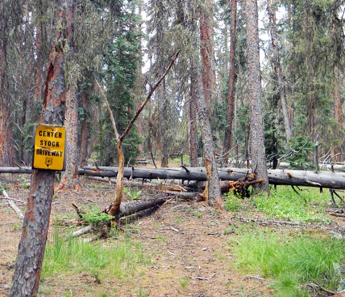
The lower part of the trail winds through a pine and spruce forest, and is lovely. The trail follows what is euphemistically designated as a "stock driveway" - see the picture below.
Much of the lower part of the trail is obscured by deadfalls like that one. About 3/4 of a mile above the trailhead, the trail simply disappears in an area of deadfall several hundred yards wide, which I detoured around with the aid of the map in my GPS. Without that GPS map, I'd have had considerable trouble finding the trail on the other side.
"Stock driveway" my foot. The only way to get a cow up that trail is as a sling-load under a helicopter, a procedure to which I expect the cow would strenuously object.
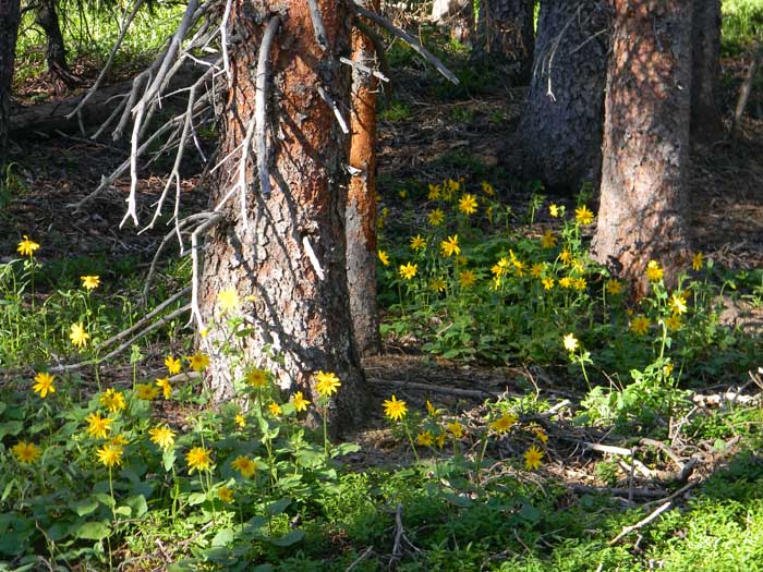
The woods are lovely, with flowers of various sorts and lush green vegetation. There are also lots of bugs, flies, and mosquitos big enough to stand flat-footed while making love to a turkey. The bugs are not a problem if you keep moving.
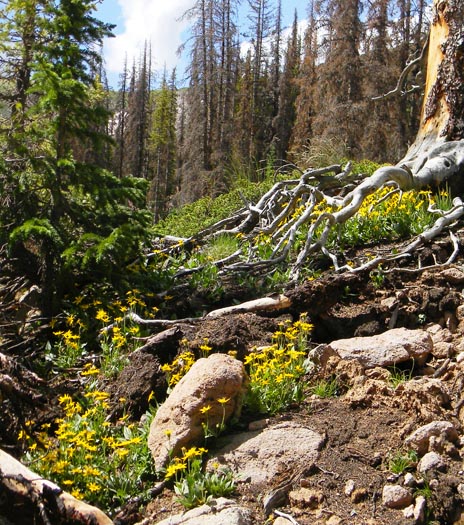
As the trail climbs, the vegetation thins out, and eventually one reaches the snow line - but there are still flowers.
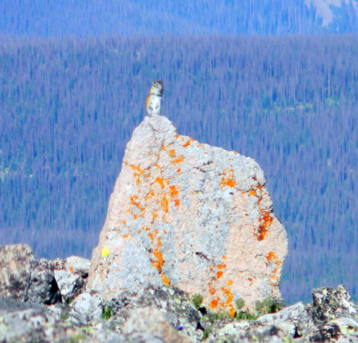
You effectively lose the protection of the trees right around 12,000 feet, and from there on are climbing through alpine tundra. I heard a pika whistling to alert his buddies to my presence, and managed to get a picture of him, which shows how well he is camouflaged as well as the incredible variety of lichen which grows at altitude. He's sitting right on the high point of the rock.
I thought I had reached the summit when I found a marker, so I took off my pack, drank some water, and sent a location update out on the SPOT transmitter.
Then I noticed a couple of things. One is that I wasn't high enough to be at the summit - I was about 200 feet too low. Also, I hadn't hiked far enough, and the summit register described by Donna Ikenberry in her book Hiking Colorado's Weminuche & South San Juan Wilderness Areas wasn't there. (If you're going to hike in this area, you'll want the book.)
So, I noticed another peak to the south. I consulted my map and the GPS. Saddle up, bubba, you're not done walking yet. The actual peak is a mile to the south of where I was, and about 250 feet higher. Oops. Another 30 minutes of walking and picking my way over loose rocks got me there. This is what the marker looks like:
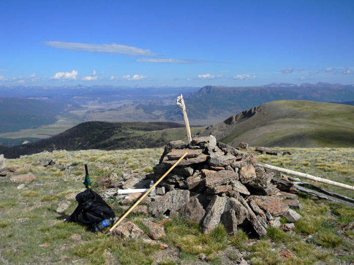
The white PVC pipe section next to my pack houses the trail register, which I signed. No one had signed it since May. I bet getting up there in May involved a lot of travel over snow. Some thoughful soul wired the skull of a small animal to the pole in the summit marker.
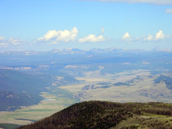
Below is the view to the northwest. Since, as you can see, clouds were gathering at my altitude, and it was about 10 minutes before 10 A.M., I decided to head back down.
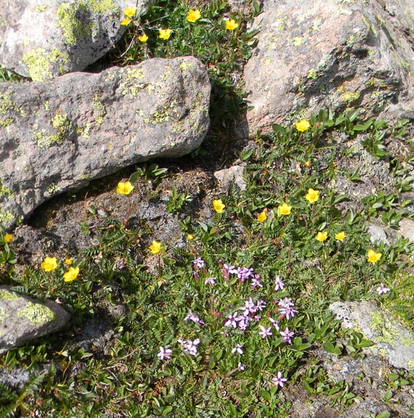
I stopped on the way to take a couple of pictures of the tiny but pretty flowers near the summit.

I was back at the truck in about 2 hours, having hiked 8.2 miles, with a total elevation gain and loss of about 4,950 feet. Back in the RV park about 1 P.M., I drank a beer, ate about a 1000-calorie lunch, and took a nap. Another nice day in the mountains.
All Rights Reserved