
Photographs by Lindy Sisk, Brittany Fraser, Zack Fraser, and Nick Keith
© 2016 by Linden B. (Lindy) Sisk, Brittany Fraser, Zach Fraser, and Nick Keith
All Rights Reserved
|
|
"You are nothing to the mountain, nothing to the ocean. You can sometimes make one mistake, sometimes two. Then you die. In earlier times the possibility of death was a given — now we have this cell-phone culture where you always expect to be saved. Suddenly people are shocked when somebody dies."
— Mark Jenkins, climber and writer
Warning: the routes traversed on this hike should be attempted only by experienced hikers in excellent physical condition, with the proper equipment to survive severe weather at altitudes over 12,000 feet, and with the ability to navigate in the absence of obvious trails. We carried satellite communications equipment which allows us to communicate to the outside world — and we use it.
I have hiked and backpacked with Tristan MacDonald in six countries distributed among three continents. Should the reader be interested, many of those trips may be found on the Arcanamavens Travel Link Page. Some of those trips, though, have been with his grandchildren, Brittany and Zach Fraser, on their summer vacations, with perhaps a few other friends. It has become somewhat of an annual tradition since the first one.
In 2011, Tristan MacDonald organized and led a hike of his two grandchildren, Brittany and Zach Fraser, and me on a hike along the Continental Divide. That story is told here.
I was not present for their trip to Creede in 2012 — I was recovering from surgery in Texas.
In 2013, Tristan, Brittany, Zach, and I did an overnight trip into the Grizzly Gulch trailhead, and the next day summited not one but two "14'ers", Sunshine and Redcloud, the following day. There is no web page for that hike, but I need to build one.
In 2014, Tristan lead a group including Zach Fraser, but not Brittany, into Chicago Basin, a story told here.
In 2015, Tristan, Zach, Brittany, and I set out to do the Rock Lake Semi-Loop — which we did, save for Tristan, who got a ride out on the second day in a helicopter. That story is told here.
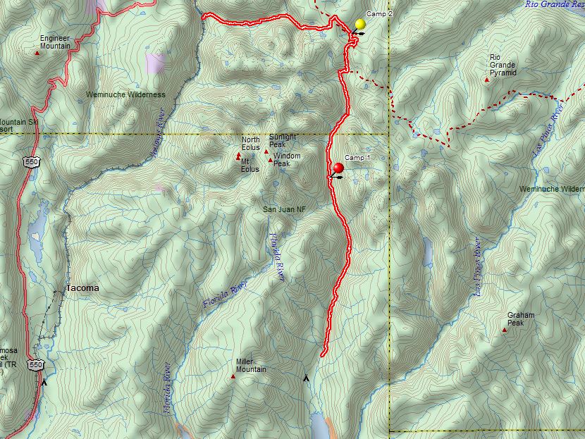
And now, in 2016, Tristan proposed that we assemble the same group again, with the addition of Brittany's friend Nick Keith, to do a hike in the Weminuche Wilderness of Colorado, starting near his home in Durango, and I immediately accepted. A map of the route is shown below, starting again this year near Vallecito Reservoir and ending at Molas Pass, except for me, as I planned to ride out on the train from Elk Park, meeting my lovely wife Kaci, who would be riding back on the train from Silverton.
As not infrequently happens in the mountains, the story didn't go quite the way we had in mind — but there were no helicopter rides.
 |
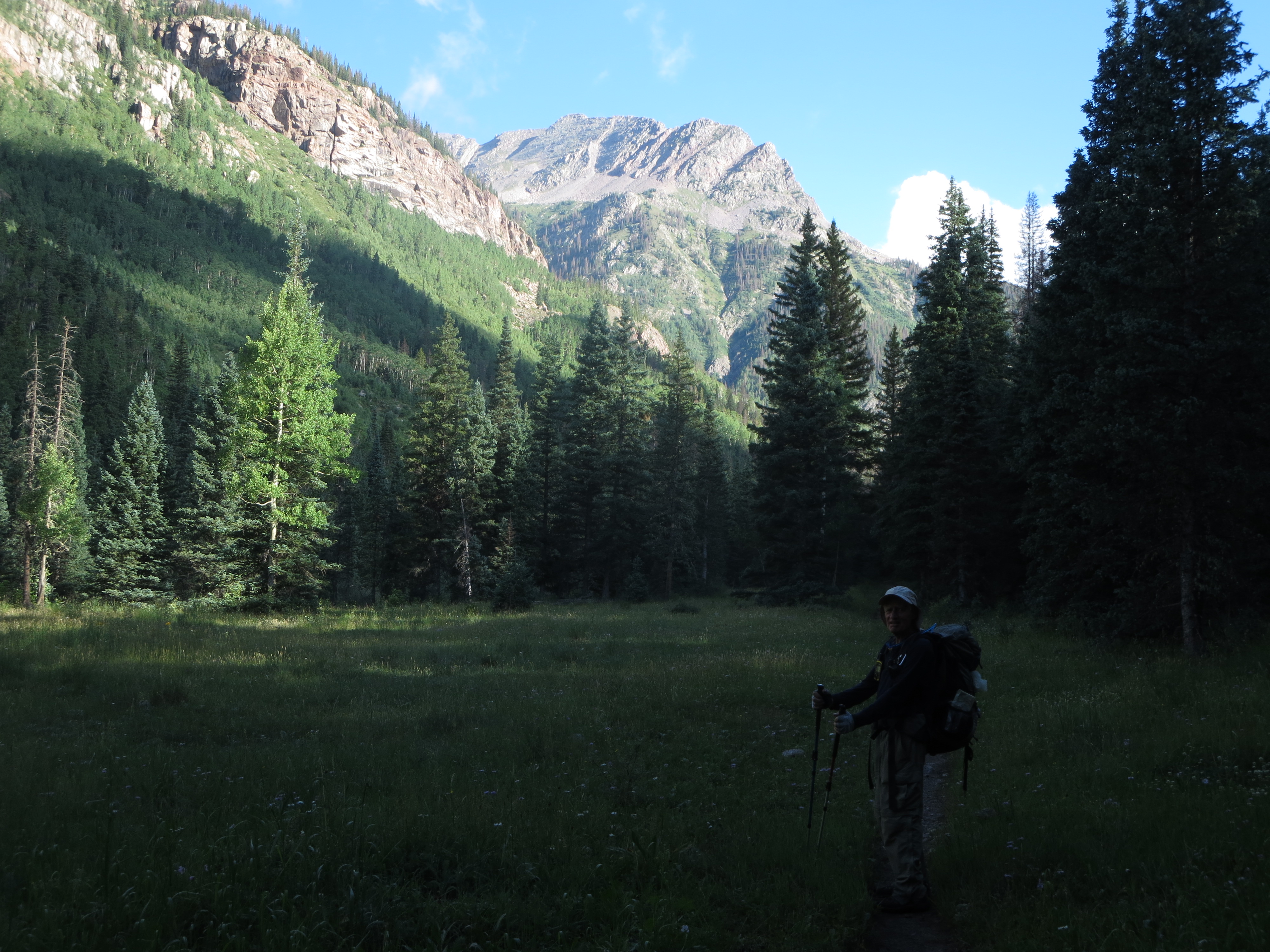
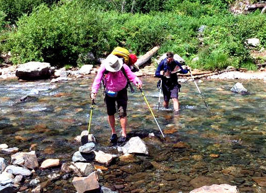 We arrived at the trailhead in two vehicles, said goodbye to Alex and Kaci, and headed up the trail. The trail profile is pretty flat in this section, and we wound our way up the valley, crossing Vallecito Creek twice on bridges before having to wade it. Last year, the creek was running high and fast enough that we needed the rope which some kind soul had left strung across the creek at the crossing point, where a bridge had been years before which had been destroyed by high water. The Forest Service has decided that because it's a wilderness area, that it will neither replace nor repair any bridges in this wilderness area. I don't think that is an intelligent policy, because the existing bridges are in places where it would be difficult to construct trail extensions at feasible crossing points, and that may well mean that the trail will be abandoned when the two existing bridges are destroyed or become unusable. However, my opinion has not been sought, and, if offered, would most likely be ignored.
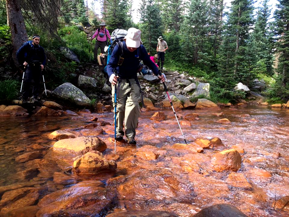
This year, there was no rope. We changed into wading shoes, and crossed without incident, not even getting our knees wet, as you can see by the picture of me, on the left, and Nick making the crossing. (Photograph courtesy of Zach Fraser.)
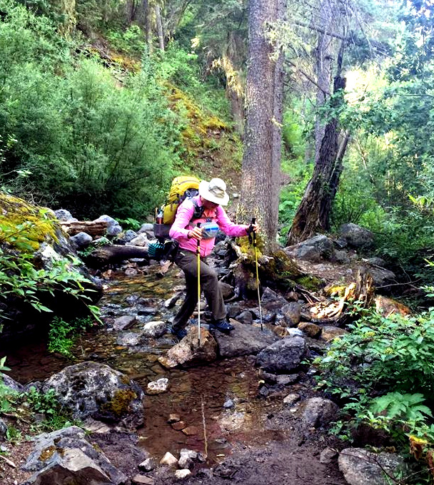
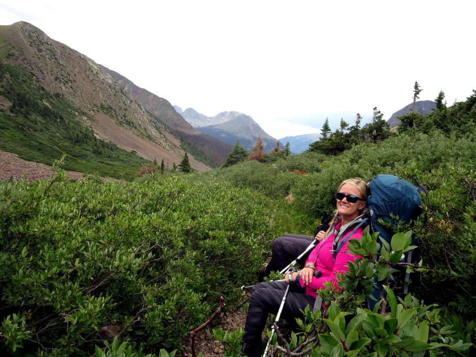
After crossing the creek, we hiked on northward toward our planned camping spot. The trail, as shown on the picture on the left below, was often rocky and rough, requiring careful placement of both feet and hiking poles. As I have mentioned in previous articles, I had never hiked with poles until I would not have made it up a steep slope in the Patagonian Andes without the assistance of a pair of them which were loaned to me by Tristan MacDonald, and I have not hiked without them since. There were other side creeks which fed Vallecito Creek.
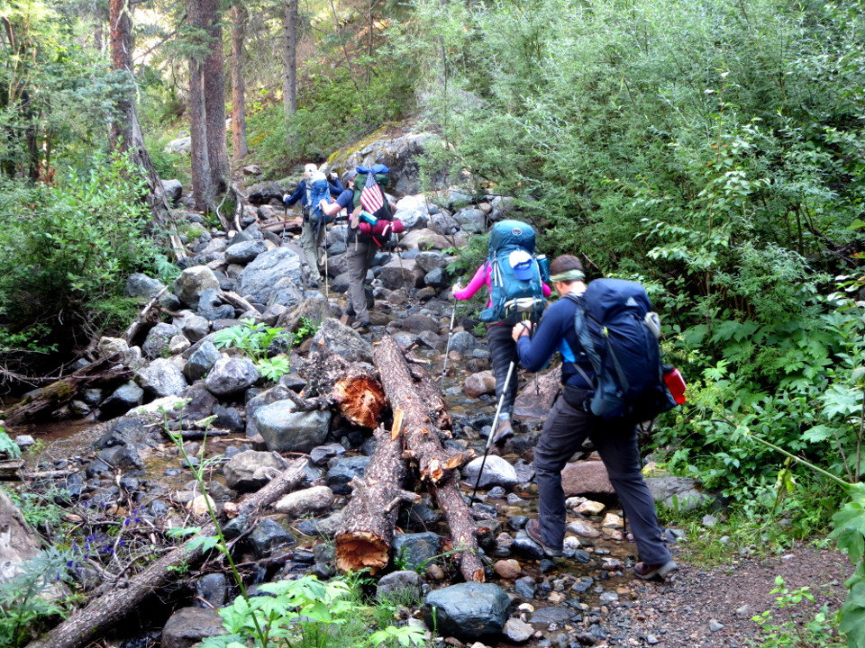 Rocky trail |
 Photograph by Nick Keith |
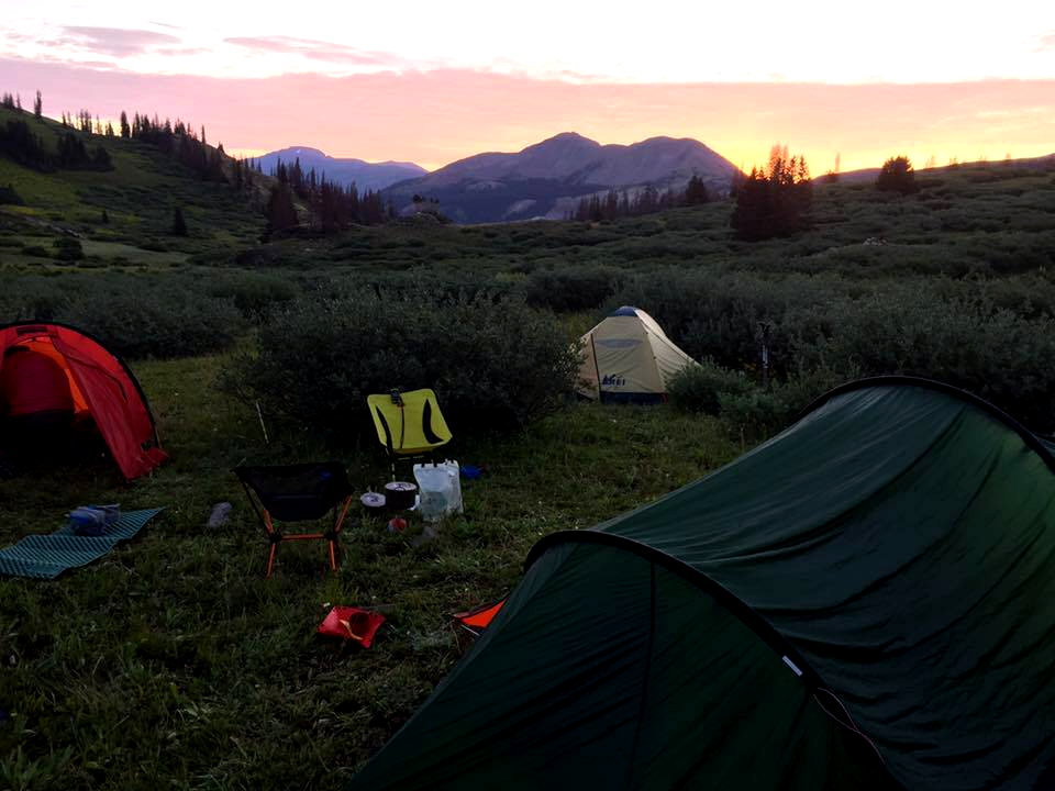
The previous year, we had passed a nice camping spot near Roell Creek because it was occupied by another party. This year, it was empty, and we decided to occupy it, even though it was a mile or so short of where we had planned to camp. We were tired, and it really is a great camping spot, with great tent sites, and plenty of dead wood nearby to make a fire, which Zach did. We cooked dinner in our usual fashion. For the uninitiated, we carry freeze-dried dinners, which can be prepared by measuring the requisite amount of boiling water into the foil pouches into which they are packed. Each pouch is supposed to feed two people. Because that amounts to a serving of only about 350 to 400 calories per camper, we supplement the pouch with some couscous and additional water. Mister MacDonald has accurately, in my opinion, described backpacking as "slow starvation", because it's difficult to carry enough food to replace the calories expending in hauling a heavy pack several miles down a rough trail. However, we do carry trail mix and other snacks, and over the course of a few days, the calorie deficit does not constitute a serious problem. On longer hikes, though, it can be a problem.
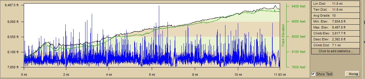 |
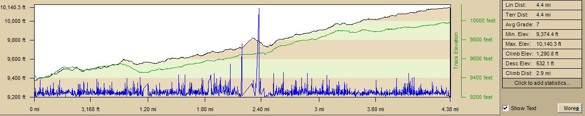
So, as one can see from the profile above, we had good reason to be tired — a bit less than 12 miles, but an average grade of only 10 percent. One thing is worth remarking upon — although we wound up quite a bit higher than we started, trails in the mountains don't go only uphill or downhill: we had a total elevation change of 6200 feet, or more than a vertical mile.
I went to bed while the young people were still sitting by the fire. We were carrying three 2-person tents. I carried and occupied by myself my Hilleberg Anjan 2 tent, which was luxuriously spacious for a single person, though it meant that I was carrying the just less than 4 pound weight by myself.
We had a light rainshower during the night at around 3:30, which caused me and a couple of others to rise for a quick bathroom trip, upon the premise that if it were going to rain, we wanted to get it over with in case it rained for an extended amount of time. As it turned out, it stopped raining almost immediately.
We rose at first light, and prepared breakfast, coffee and oatmeal, packed up, and hit the trail. It had cleared up during the night, and the morning was beautiful. We headed north up the trail enjoying the morning light.
 Morning light |
 Crossing Rock Creek Photo by Zach Fraser |
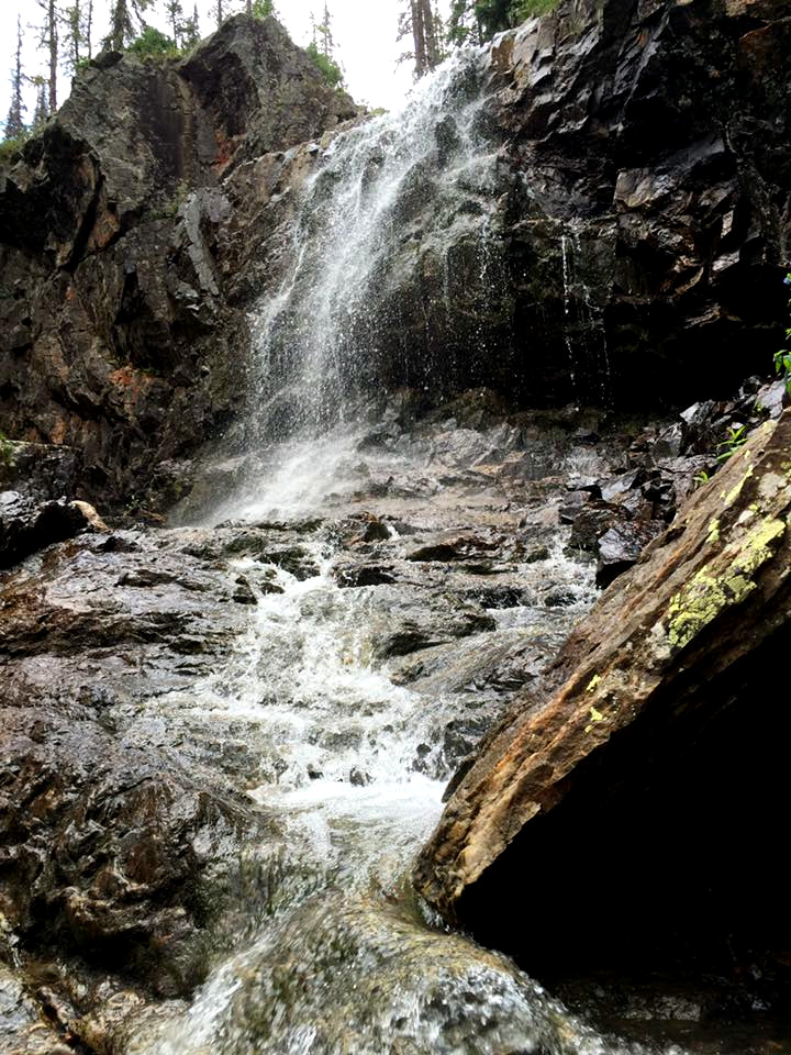 Photo by Zach Fraser |
This year, Rock Creek was running low enough that we stepped from rock to rock without having to change into our water shoes. While we were getting water from the creek and preparing to continue, a party of wranglers passed by with mules loaded with a camp set up. The wranglers were friendly and wished us a good trip. The party of riders behind them were less so, passing by without either a glance or a word. It isn't the first time that we have encountered riders who exhibited a lack of respect for those us us afoot. We continued on, finding a spot for lunch near Nebo Creek, which had a splendid waterfall. We had a lunch of summer sausage in tortillas and Ramen noodles.
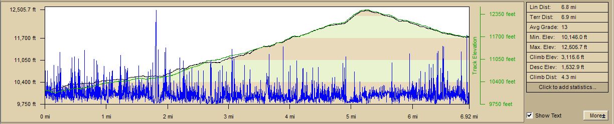
After lunch, the real work began. The trail now rose quite steeply as we ascended toward Hunchback Pass. As you can see from the trail profiles below, the average grade on that stretch, beginning at Rock Creek, was 13 percent — but that was the average, as my GPS recorded instantaneous grades of 25 percent. At times we just walked a few steps, and stopped to breathe. (There are two profiles because I stopped at Rock Creek to change batteries in my GPS.)
 |
 |
On and on and on we struggled. The weather became overcast, and there were showers to the southeast, as the Southwest Monsoon pattern was starting to set in, which results in showers in the mountains, especially in the afternoons. For more information on what that is, see The North American Monsoon.
 Weather... |
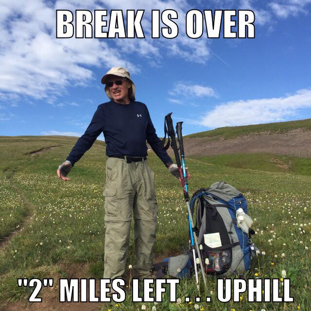
 Pack break |
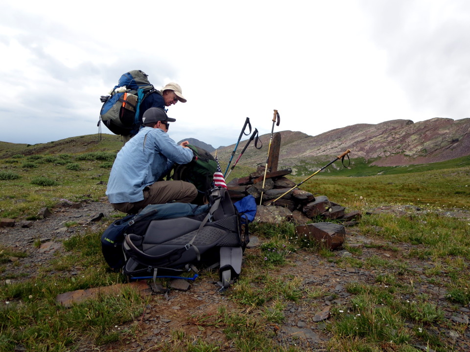 Zach and Tristan at the pass marker |
We finally reached the high point of the pass, and took a well deserved break. Then we began the descent into the area of Kite Lake. We looked for a camping spot. The best spot, on a high point to the east of the lake, was already occupied by the horse party referred to earlier, and we didn't want to be near them... We wandered around a bit, discussing the route out the next morning, and finally settled into a very nice spot near Bear Creek. We set up tents, and the water party ventured to the creek to sterilize the water for dinner cooking and drinking.
Tristan had brought two Steripens. Tristan, John Tesdorpf, and I had used Steripens on a trip to Patagonian Andes in 2012, and both had failed in use. Although they were repaired or replaced under warranty, I was unwilling to trust them, and looked for alternative solutions. I have found the Camelbak All Clear to be much easier to use, and faster. The rechargeable battery will sterilize 50 liters of water on a charge, and although I carry a means to recharge it, I've never needed to recharge it, although that would obviously be a function of the length of the trip and the size of the hiking party.
For the day, we had walked 11.2 miles, ascended 4407 feet, and descended 2165 feet, for a total elevation change of 6573 feet. To put that in perspective, using the average 10 foot height of an average building story, this was about the equivalent of climbing the stairs to the top of a 327 floor builing — and then walking back down again!
That evening, I used my DeLorme inReach to check the weather forecast. We had already seen significant thunderstorm activity, and the forcast was for a high probability of heavy rain the next day, and the day following. We had planned, as noted previously, to descend the next day — Tuesday — to the vicinity of Elk Park and camp overnight, with me remaining on Wednesday to catch the train out in the afternoon to rendevous with my lovely wife, and the rest of the party hiking out to Molas Pass for pickup by Alex and Gaere MacDonald. Given that the trail up to Molas Pass is short, but quite steep, it was decided that we might decide to modify the plan, as a steep and muddy trail can be dangerous, and all ride out on the train. We didn't have to finalize a change in the plan, as the ability of the inReach to communicate by either text message or email to Alex as well as my wife meant that we could decide that on the fly.
The inReach has become essential equipment for travel anywhere cell service is not available. Tristan and I both carry one, and we have used them in North and South America, as well as in Europe. They provide 2-way communications anywhere in the world, as well as access to rescue resources, by way of the Iridium satellite constellation. Many people think that cell service is always available when traveling by car — but it isn't, and for that reason, I carry mine in the car when traveling outside the local area. I'd sooner leave home without my American Express Card than the inReach.
 Camp 2 |
 Magnificent sunrise at Camp 2 |
 Yes, the white stuff is snow |
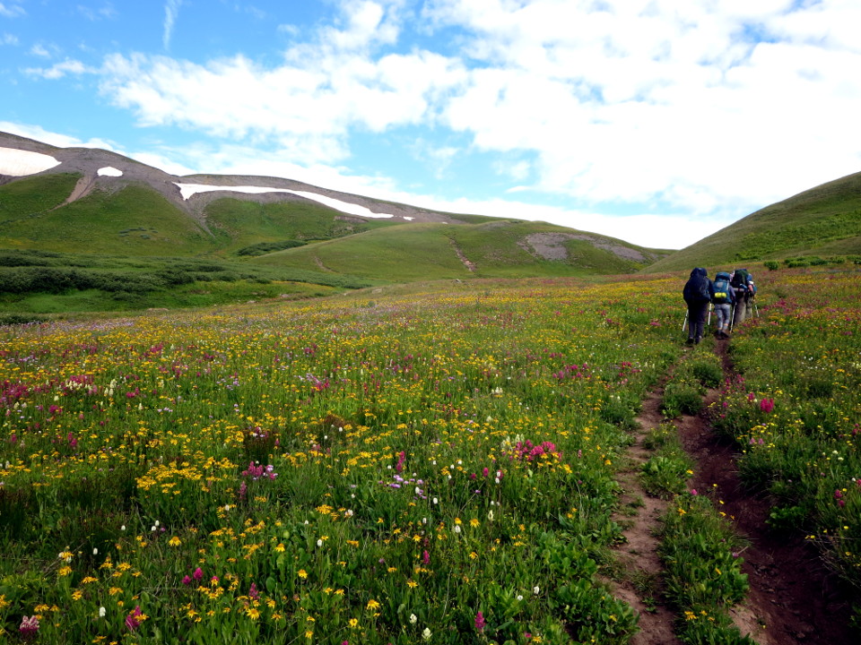
We ate breakfast and packed up expeditiously, although there were no immediate signs of impending bad weather, save for the old saying, "Red sky at night, sailor's delight — red sky in morning, sailor take warning." The trail out of the Kite Lake area rose toward the junction of the Continental Divide Trail and the Colorado/Elk Creek Trail past old mine ruins and through beautiful fields of flowers. We saw other hikers descending toward the junction on the ridge line to the west, where the snow is on the ridge in the picture above to the right.
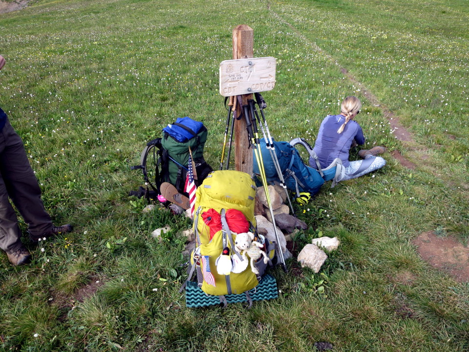 Junction of the CDT and the Colorado/Elk Creek Trails |
 Starting the descent |
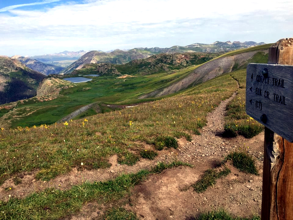 Photo by Nick Keith |
We reached the junction of the CDT and Colorado trails, and took a break. Although we started out on a 38 degree F. morning, we had by then already climbed nearly 1000 feet, and climbing will make you sweat, as one can see from the sweat stain on the back of Brittany's shirt. The views were magnificent in all directions!
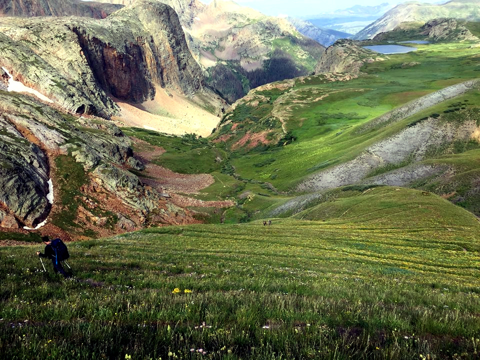 Photo by Zach Fraser |
 A pretty beaver pond. |
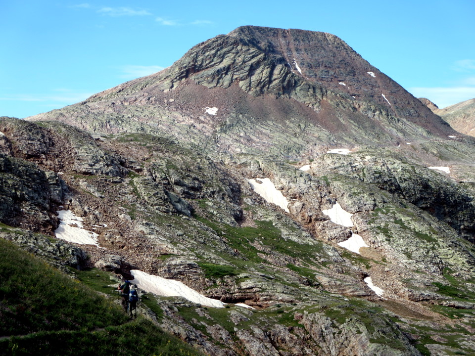
The trail was rocky in many places, and steep.
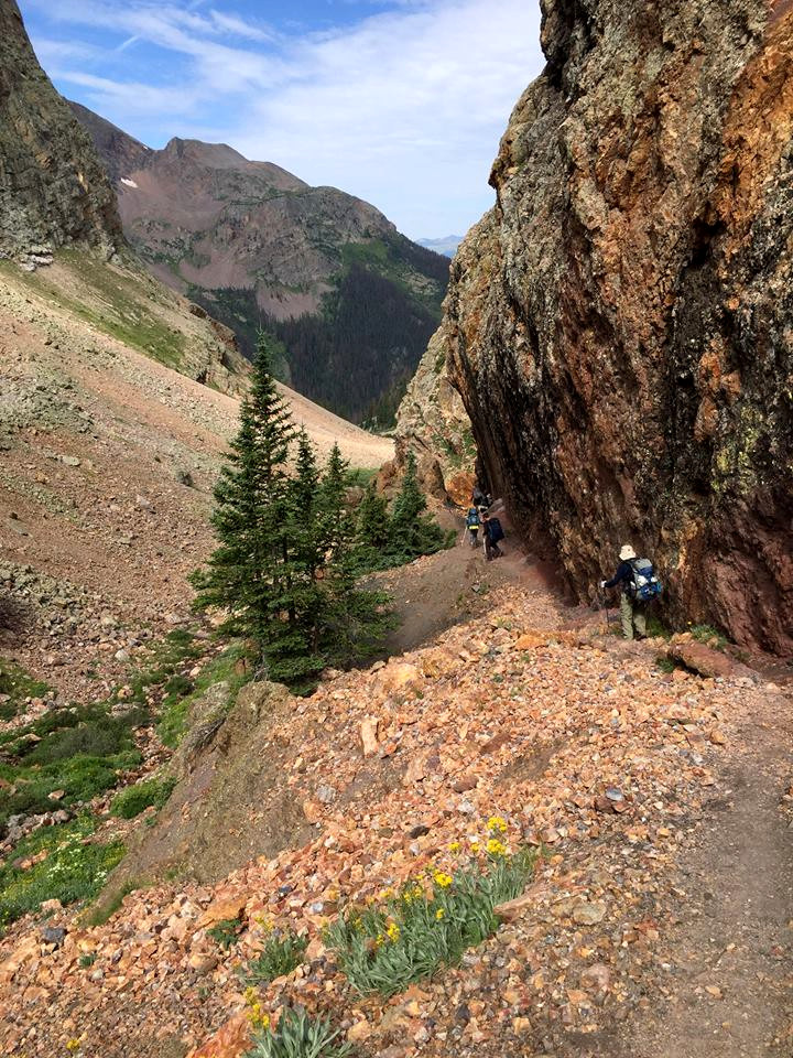 Photo by Zach Fraser |
Concerned about the weather, we made haste down the trail — far too much haste. We didn't stop to eat lunch, and we didn't stop enough to restock on water. As a result, we reached the bottom tired — exhausted, in my case, but in plenty of time to catch the last train to Durango at about 3:45 PM. And it never did rain until we were actually on the train, and headed down to Durango — such is life in the mountains. The train ride was wonderful — the concession car was well stocked with beer and other wonderful beverages, and we all engaged in conspicuous rehydration.
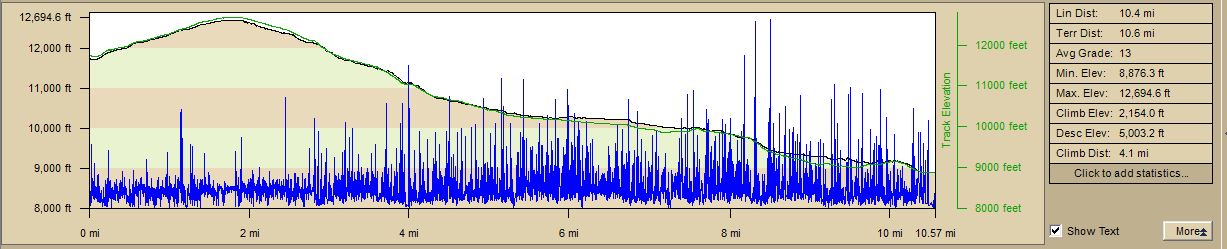 |
So, for the last day, we hiked 10.6 miles, climbing 2154 feet and descending 5003, for a total of 7157 vertical feet. My legs were sore for a couple of days after, but the difference between the descent distance and the climbing distance on that last day reaffirmed something that I have long held to be the case. One uses one's leg muscles differently in descending than one does in climbing. I could climb stairs the next day, but descending them was extremely painful. The question, then, in training for a hike like this, is how to train adequately for the descents, a question I have not resolved entirely to my satisfaction. When I lived in Houston, and worked in a 13 story building, I used to take the elevator to the top floor, and walk down the stairs, repeatedly. I have no such facility now.
And now, for the theme of the hike, as provided by Brittany:
 |
During the three days in the mountains, then, we traveled 33.4 miles, ascending and descending a total of 19,930 feet! So — a casual observer might reasonably ask why we endure this, not only the rigors of the actual hike itself, but of the training required beforehand. The land we walked through belongs to all Americans — but it's wilderness. If you want to see it — and the pictures reflect only a pale shadow of its magnificent beauty — you have to walk. In addition to that, there is the comradeship of the trail, for which I thank Tristan MacDonald, Brittany and Zach Fraser, and a new companion this trip, Nick Keith. I would also be remiss if I did not thank the many volunteers who labor tirelessly to maintain the trails in areas like this, as well as the Forest Service employees who do so — we met two young ladies of the Forest Service carrying heavy packs and Pulaskis, who were out on an 8-day trail maintenance trip.
I intend to keep doing this until God in His wisdom makes it impossible for me to continue. The example of Tristan MacDonald, in the year of his 80th birthday, provides hope for me that it will be possible for years longer. I am very blessed.